Bend, OR > Missoula, MT: 624 Miles
(averaged 78mi/day)
View Driving directions to W Spruce St in a larger map
A few highlights from the week:
Now for a brief breakdown (of the week):
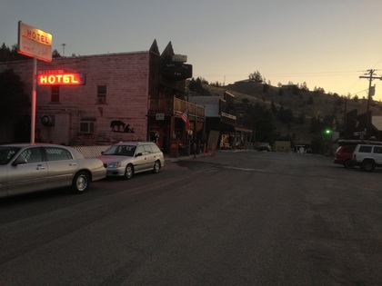 Mitchell: smaller than a one-light town.
 Because he offered, I got a lift from Austin from Bend up to Redmond around 10a. I was just about ready to roll on out of Redmond when I realized that I didn't actually have everything I needed! I had forgotten my sunscreen back at the Merrill's house when I put it in with the other stuff from cliff-jumping. So I went in to the Antiques store that was right there and asked where the closest sunscreen place was. It was a Fred Meyer back into town about mile. I rolled over there, picked up from SPF50, lathered up and was on my merry way. It was HOT and there was a decent climb on this 67-mile day.
I was fading reaaaaally fast by the time I got to Mitchell. It's a "town" of around 170 people and I barely made it before all the shops were buttoned up. I stopped at the first store I came to, which was a closed cafe. It had a soda vending machine outside though, and I immediately bought an orange soda. I plopped down at the picnic table outside and polished off my soda along with the rest of a Subway sandwich I picked up earlier in Prineville. After I felt like I could continue, I got back on my bike and pedaled the few hundred yards into the main part of town to find more food. I went in the only open place I saw and ordered a burger and a PBR. It was just what I needed, but the restaurant was so friggin hot inside that I almost couldn't stand it. After chowing down, I went across the street to the park and set up camp (fo' free). It would have been a restful, stress-free night except there was a skunk rustling around my stuff and eventually the other cyclist's stuff too. The stupid crows were at it again at the break of dawn and then the sun finally kicked my out of my tent around 9a.
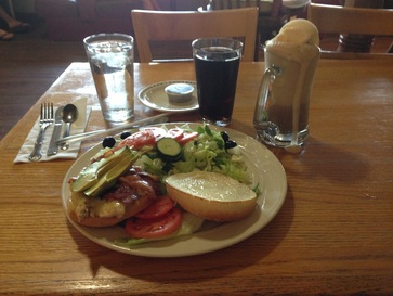
I took a hint from the day before and took a long break in the middle of the day so as not to ride in the hottest part of the afternoon. Around 1p I stopped in Dayville for a lunch that would include a primo over-flowing root-beer float. I was there for a few hours updating the blog and generally catching up with the rest of the world. As I was packing up, an older, not-quick-to-smile Dutch guy named "Hank" walked in and struck up a conversation wtih me as he sipped his orange juice. He was on his 6th big tour but the first one in the U.S. The others included riding from his home outside Amsterdam to Spain, Amsterdam to Rome, Amsterdam to St. Petersburg, Russia, and another from Amsterdam to Jerusalem. I certainly couldn't complain about the distance after hearing that.
Continuing on through more high-desert and dry prairie, I finally made it to Mt. Vernon and ended up staying at a bicyclist-only hostel of sorts called the Bike Inn Guesthouse. It's run by a woman who is very into cycling and used to find cyclists passed-out on the road near her house from heat-stroke. The story goes that since she was taking these people home to care for them anyway, why not create a place to stay between the more major cities. So she did and that's what the Bike Inn is today. It's a donation-only guesthouse in the back of her property. It had a shower, clean towels, sheets, pillows, futon, full kitchen, left-over food from other cyclists and a HUGE collection of VHS movies. It was a perfect place to stay except for the heat again. It took many hours to fall asleep that night simply because it was still so, so hot.
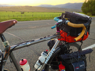
Today was longish and had three little peaks back to back to back. It was also stupidly hot, though it turns out it was unusually cool for the time of year... Yikes.
I was amongst Oregon Trail Country for sure, as I kept passing signs and other markers for Trail happenings and history, especially towards the end of the day. Speaking of that, the final stretch of road into Baker City was completely flat, completely straight and had a really strong wind blowing completely in the wrong direction (into my face). I hate roads like that. The only saving grace was the scenery which was pretty awesome to be honest. Once again, I was arriving at my destination around sunset and the sky was all kinds of pretty colors. Photos could never do it justice. I wandered down Main Street ogling at all of the neat old gold-rush buildings and eventually made it over to Safeway for a few dinner supplies before arriving at my over-night RV park home. The biggest thing of note that happened that night was that I very narrowly escaped a large branch which fell out of the tree above my campsite. It miraculously didn't hit anything even though it was the size of the picnic table I had a lot of gear spread out upon.
Another morning that came too early thanks to the crows and another hot day it shaped up to be. Getting ready in the morning, I was approached by an older, slightly unkempt guy with bad teeth who called himself "Uncle Dave." He was doing a bike tour of sorts too through the mountains of Eastern Oregon looking for wild horses. We wound up making small talk for a little bit and then he disappeared. I continued packing up when he reappeared and stated that he wanted to a little audio-only interview recording about my trip, etc. It turned out to be a really long, mostly one-sided discussion (on his part) about how the internet has no soul, how your stomach has brain neurons that think, and how you need to live a sovereign life in order to find meaning in it. It came out later that he was from Hawaii and had been smoking a lot of pot over the last few days in the mountains and had smoked again that morning. I did my best to seem engaging as I really just packed up the rest of my stuff to get a move on since it was almost 1pm at that point.
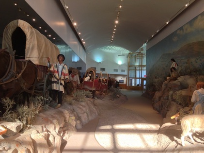
From reading the Mountain View RV Park guide to Baker City, I learned there was a guided hotel tour of the old Geiser Hotel at 1pm on sundays, so I rode back down to Main Street, struggled through the front door with my bike and waited for the tour to start. It was a neat old but recently renovated building that was started well over 100 years ago when the Gold Rush was in its infancy. After that, I tried to make it to the local US Bank branch to see their collection of gold nuggets but being a Sunday, they were definitely closed. Moving on out of town, I hit the final tourists attraction of the area which was the National Historic Oregon Trail Interpretive Center. It was an awesome hill-top museum of Oregon Trail history, with all kinds of artifacts from the time. The Center itself is located along the actual trail and you can still see ruts in the dirt from where the thousands of wagons crossed that spot. By this point I had all but forgotten about Uncle Dave and the fact that he told me he was considering stopping up there again and I was less than excited to see him waiting for me when I exited the building. His plans were to stay in Baker City that night but he chose to ride with me out of town for the next several miles. Like Yaniv, I managed to distance myself somewhat unintentionally from my new friend and after a while, he decided he wanted to check out a dirt trail used by ATVs. So we parted ways and I meandered down to Richland. It was about 6pm when I left the Interpretive Center and had maybe three hours of day light to make it the 30+ miles to Richland. It was another nice evening sky to behold as I found the local park to camp in for the night–a big covered picnic area attached to a baseball field.
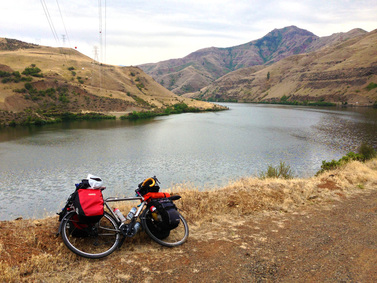 I think a Moots is drawn to water, right?
 A new day, a new state! But before I got to the border of Idaho, I stopped for lunch in a town called Halfway. Definitely a farming town, as exemplified by the spurs worn by a mom also eating lunch in the restaurant/biker bar. I noticed there was an unusually high density of touring cyclists also. Turns out they were all part of a guided/supported Adventure Cycling Association TransAm tour (the same company that makes the maps for the route I'm following) and they were stopping there for the night. I met one of the group leaders, Lee Goode, as when I was about 10 miles past Halfway and he let me in on a few good tips for my upcoming journey. He also pointed out a bald eagle doing loops near the top of the ridge we were riding through. I told him I'd say hello to all the people in Missoula at the ACA headquarters for him.
As per his recommendation, I stopped a little ways down the road for some ice-cream and bottle refills at a stand-alone gas station called Scotty's. For $2.25, the woman working there essentially gave you a giant bowl's worth of ice-cream. Easily the best ice-cream deal yet. It was pretty hot in that little valley so the free ice water and copious amounts of ice-cream were muchy appreciated. Not much farther was the Oxbow Dam, one of three major hydro-electric facilities along the Snake River that forms the border between Oregon and Idaho. The road around this area was in relatively rough shape since it seemed like it was more of a service road for the Dam and I was glad to be out of there. The scenery was still bleak in my opinion even though the river was right there. For some reason, all I could think about was Rick, one of the mechanics at MOAB. I think it was probably because I've heard him talk about racing mountain bikes at Snake Creek in Georgia so much. The road finally improved after the Brownlee Dam/Idaho border which just so happened to be where the valley opened up too, so the day became much more enjoyable. There was a rest stop along the river where I doused my head with cold water before tackling the big, long climb up out of the river valley. Once I crossed the pass, the going was downhill to flat as I made it into Cambridge. My campsite for the night was their town park and this one had visitors! A couple my age were doing the TransAm the other direction and were just about to go to sleep when I arrived. Haha, the ground was pretty much completely saturated though around the park because the land was directly underneath the town water tower. But I did have plenty of fresh water that night. Not a bad trade.
Not too much to write home about along this section. I rode along a torn-up road, stopped for pizza, passed through a town that was nothing but a lumber mill, watched the scenery change to a more alpine climate, and camped along the Salmon River in the tiny rafting and jet-boat town of Riggins. The stars at night have been pretty spectacular out west since there's almost no light pollution. I've seen the Milky Way the past few nights which is something you can never see in Nashville. I took the below time-lapse while camped out along the river.
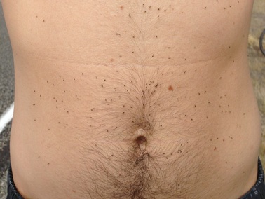 Bugonbugonbug.
 Possibly the hardest day so far. It wasn't particularly long, it just had a stupid climb that went on forever in the once-again oppressive heat. Before all that though, I spent the morning eating a big breakfast for the first time in a while and figuring out where and how to get cash that wouldn't charge me a fee so I could pay for my campsite the night before. Once all of that was taken care of, I moved on towards my next stop. The route went along the Salmon river for a while and was certainly a pretty site except for the clouds of gnats that I happened to plow through every few hundred yards. It got to the point that there wasn't any better way to get rid of them than jump in the river. So I did. I pulled over after a while at a boat ramp entrance to the river, changed, and splash! Instantly clean! And refreshed! But mostly clean.
It took a long time for my breakfast to not feel like a bowling ball in my stomach and that made progress pretty slow for a while. It didn't help that I was approaching that douzie of a climb I mentioned before. It was right after a tiny blip on the map called White Bird. It could have been worse I suppose if I had continued to follow Hwy 95 up the ridge at 11% for about 10 miles. Instead, I followed Old Hwy 95 which was twice as long, but certainly not quite as steep. There were a lot of switchbacks to keep me entertained, but I was nauseated from the heat so I didn't feel very entertained. There was a forest fire somewhere too because the valley was filling up with a smokey haze as I rode up the ridge from White Bird. It was another very scenic section though and also happened to be where the first battle of the Nez Perce War happened in 1877. I finally got to the top of the climb after a few hours and I thought I heard someone laughing at me. It was a goat on a little farm/ranch/B&B at the summit. Stupid goat.
The downhill was nice towards Grangeville, though I did get stopped by some free-range cows that had taken up residence in the middle of the road. Once in town, I scouted about for a BBQ place that might have a famous Idaho baked potato on the menu. No luck, so I settled for a Mexican spot. It was a good choice because the platter of food was the biggest plate of food I've ever been served. I ate until I was stuffed and had only made through half of what was on the plate. I love left-overs! After packing up the rest of my dinner in a to-go box, I went to find the Lions Club park on the outside of town that allowed camping. There were some rumbles of thunder that night but I almost didn't believe it since I hadn't seen rain in over a month. I put my rainfly on the tent just in case, but no storms ever materialized. I slept pretty well too and that was a welcome change.
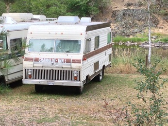 Along the river in Harpster, ID.
 The next morning when I went to the park bathroom to change into my riding clothes, the heavens opened and it poured for about 10 minutes. Fortunately I had put all my stuff under the awning of a covered picnic table area and nothing really got wet, except me when I ran back across the field to my spot. I chilled out for a while, eating my Mexican left-overs and reading some pamphlets about the Nez Perce War to see if the rain would stop. It let up mostly around 11a and I finally got underway. It was a little chilly due to the weather but it was a welcome change. The road turned downwards for a while not too far outside of Grangeville so it was a gentle warm up for my settling Mexican food.
I had looked ahead at my maps and saw that there was a section coming up that went through one of the largest wilderness areas in the Lower 48 and that meant no services for more than 60 miles. Not really knowing what that meant, I stopped at the next town of Kooskia to stock up on food and liquids. I had originally planned on stopping for the night after about 50 miles in a town called Lowell. Once I got there, I just felt like riding some more since the day had been so easy. I did get an ice-cream sandwich and refilled my bottled before I took off though. About that time however, they sky started getting very ominous looking. Evidently there was a storm rapidly materializing that potentially included, lots of rain, penny-sized hail and gusts up to 50mph. It was moving the same direction I was and so I chose to risk and continue on. I wanted to do about 25 more miles that day but I knew I had a bailout option about 7 miles from Lowell. I clicked my bike into a harder gear and rode just ahead of the storm for about 30-40 mins until it ultimately caught me. I had just reached bailout campsite when the storm hit and was able to find shelter under the awning of little bathroom building. It rained pretty hard and gusted but it wasn't nearly as bad as the weather report made it sound. I put on some warmer clothes to ride out the storm, ate my sandwich, a few Little Debbie oatmeal cream pies and hunkered down for the next two hours. I was able to manage an hour-long nap too, so all-in-all, it wasn't too bad. By 8pm, it had pretty much stopped raining and I emerged from my hole to ride on to the next campsite. It was just getting dark by this point too, but not quite all the way yet and the next 30 minutes may been the prettiest section of a bike ride I've ever experienced. There's no way a picture could have captured it in a way to do it any justice at all. Everything was wet, the sky was grey, and clouds were so low, it was as if they were giant cotton balls that were perched haphazardly around by the thousands of pine trees.
I eventually made it to the next campsite about 20 miles farther up the road, pitched my tent and made another Ramen noodle and canned chicken dinner. It was also this stretch of road that I broke the 1,000 mile barrier! I was pretty gross since I was damp and sticky and covered in old sunscreen but it was late and I was tired enough to not really care. It rained throughout the night and everything was continued to get saturated. Waterproof Ortlieb bags came in handy that night, for sure.
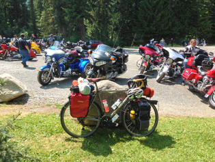 Bike rally of another kind.
 A dreary day to get started on a century ride, but ride I did. This stretch of the journey was the one that routed through the wilderness and I figured there wasn't much point in trying to split the distance into two days. So I chose to ride the 100 miles to Missoula. I originally planned on riding from Lowell to Missoula which would have been 125 miles but I'm glad I did the extra 25 the night before. This section also included a climb called Lolo Pass that tops out at 5,235ft.
The road continued to follow the Lochsa river up for a gradual 30 miles or so. The sun decided to show its face around 11:30, or three hours after I had been on the bike. I stopped at one of the wooden suspension bridges that cross the river to the wilderness trails and ate a mid-morning snack while I dried out in the sun. It warmed up just enough to be comfortable to ride with a shirt on for a majority of the day and I enjoyed not having to wear sunscreen for a time. I stopped at the Lochsa Lodge for a teriyaki burger with a slice of ham and swiss on stop, curly fries and a Blue Moon. Their back deck overlooked the mountains and it was a superb spot for lunch. I met a few other people on the property who were doing bike tours of their own across the US. One gentleman was an older Canadian man who had done the TransAm route back in the 90s and had forgotten he stayed at the Lochsa Lodge the first time until he arrived there. It was neat talking to him about it.
Moving on, I had the Lolo Pass in my way. It turned out not to be as tough as I expected it to be and that probably energized me even more to finish it quickly. At the top, a lot of motorcyclists who had passed me going up the pass were shocked that I had made it that fast and a few gave me a congratulatory hand shake. I read the signs about the local Lewis and Clark history, took my picture by the State Line and continued on down into Montana. The rest of the ride into Missoula (45 miles) was pretty uneventful. I was just glad to be done by the time I go there.
I had made arrangements to stay with Marcia, a customer of MOAB who now lives in Missoula. She greeted me at the door to their apartment, helped me unload my bike and take all my gear upstairs. I quickly showered and sat down to a huge spread of home-made pizza, salad with beer and wine. It was all topped off with some home-made peach ice-cream with local peach slices, oatmeal cookie crumble and cream sherry on top. I was in heaven. I met her fiancé, Jerome and we chatted about my adventure for a while until 11p and then we all went to bed. I was looking forward to a weekend of rest. =)


 RSS Feed
